
The architectural complexity inherent in navigating the vast expanse of the lunar surface demands a level of precision that transcends traditional mapping techniques through the integration of immersive digital environments. For decades, mission planning relied on flat charts and static models, but the modern era of lunar exploration utilizes sophisticated simulation frameworks to bridge the gap between abstract data and physical reality. These visualization tools allow engineers and astronauts to walk through virtual landscapes long before a boot ever touches the regolith of the Moon. By synthesizing telemetry from various lunar orbiters, NASA creates high-fidelity digital twins of the landing sites, ensuring that every shadow and crater is accounted for during the descent phase. This transformative approach reduces operational risks while enhancing the scientific yield of each mission by identifying high-priority geological features with unprecedented accuracy. The evolution of these visual platforms signifies a shift toward a more intuitive understanding of the celestial environment, where data is no longer just viewed but experienced. As exploration targets move further into the solar system, these tools become the foundational bedrock for sustainable human presence on other worlds.
Immersive Training: Simulation and Design
Training for the unique lighting conditions of the lunar south pole requires a sophisticated manipulation of light and shadow that only advanced ray-tracing algorithms can provide in a real-time virtual environment. Because the sun remains near the horizon at the lunar poles, creating long, deep shadows that hide treacherous terrain, astronauts must learn to navigate using a combination of artificial light and sensors. To address this, developers at the Johnson Space Center utilize the Lunar Reality environment, which blends real-world physics with hyper-realistic graphics to simulate the exact conditions of the Artemis landing zones. This immersive setup allows the crew to practice extravehicular activities, such as deploying scientific instruments or collecting samples, within a controlled digital space that reacts to their movements. Such high-fidelity simulations are critical for building muscle memory and situational awareness, which are vital when operating in a vacuum where mistakes can have catastrophic consequences for the entire crew.
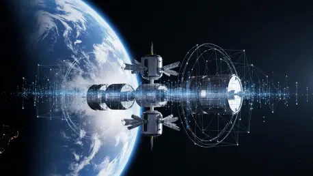
Beyond individual training, immersive visualization plays a pivotal role in the collaborative design and assembly of complex orbital infrastructure like the Lunar Gateway. Engineers located across different continents use shared virtual spaces to inspect digital components of the station, identifying potential hardware conflicts before a single piece of metal is ever machined. This approach facilitates a more agile development process, as design changes can be tested and validated in a virtual wind tunnel or microgravity simulator within minutes. Moreover, the integration of haptic feedback systems allows specialists to feel the resistance of a bolt or the tension of a cable, adding a physical dimension to the digital model that enhances the realism of the simulation. By utilizing these mixed reality tools, the development of the Habitation and Logistics Outpost has seen a significant reduction in late-stage engineering changes, streamlining the path toward a permanent human presence in lunar orbit. This seamless transition from digital concept to physical reality ensures that the systems operate with the highest reliability.
Trajectory Mapping: Managing Deep Space Data
The task of visualizing the journey from Earth to the Moon involves managing a continuous stream of telemetry that must be translated into actionable navigational data for ground control and flight crews. Modern visualization platforms ingest millions of data points from the Deep Space Network to create a real-time digital mirror of a spacecraft’s trajectory through the cislunar environment. This digital twin of the mission allows flight controllers to predict orbital perturbations caused by the gravitational influence of the Sun, Earth, and Moon with extreme accuracy. By visualizing these complex gravitational gradients, navigators can plot more efficient burn sequences, saving precious fuel for extended operations on the lunar surface or eventual journeys toward Mars. The ability to see the invisible forces of gravity acting upon a vessel provides a strategic advantage, enabling teams to adjust mission parameters dynamically as conditions evolve in deep space. This level of foresight is essential for managing the long-duration missions that characterize the current era.
The implementation of these advanced visualization strategies successfully established a new paradigm for how humanity interacts with the cosmos by moving beyond the limitations of two-dimensional observation. By grounding every mission phase in a high-fidelity digital framework, the risks associated with deep space exploration were significantly mitigated through proactive planning and immersive rehearsal. The focus then shifted toward the standardization of these virtual environments across international partnerships to ensure seamless interoperability during multi-national lunar campaigns. Future considerations highlighted the necessity of integrating artificial intelligence to generate predictive visualizations that can anticipate equipment failures or environmental hazards before they occur. Organizations recognized the need to invest in the data infrastructure required to support these massive digital twins as the volume of information grew alongside the footprint of human activity. By treating visualization as a core component of mission architecture, the path to the Moon was rendered clearer and more accessible.