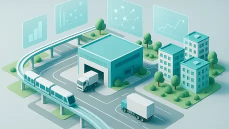

Spatial planning experts now view interoperable data as a primary form of infrastructure that is just as vital to a city’s survival as its power lines or physical road networks. In the sprawling urban expanse of regions like Jabodetabek, the sheer velocity of population growth and economic diversification has rendered traditional, siloed management techniques entirely obsolete. As these metropolitan hubs evolve into complex megacities, the demand for a “single source of truth” has become a non-negotiable requirement for sustainable development and governance. This fundamental shift toward digital transformation involves more than just adopting new software; it requires a complete reimagining of how urban systems communicate with one another to foster industrial resilience and social equity. By prioritizing standardized data formats, governments are finally bridging the gap between historical physical planning and the real-time digital ecosystems that govern modern life, ensuring that every new skyscraper or transit line is integrated into a larger, functional whole that benefits all citizens.
Establishing a Digital Foundation Through Spatial Planning
Accurate and timely spatial data serves as the foundational bedrock of any successful smart city initiative, providing the essential geographic context required for meaningful urban development. In Indonesia, the recent transition toward a “One Spatial Planning Policy” has effectively synthesized previously fragmented national datasets into a cohesive and transparent digital framework. By leveraging integrated digital platforms, the government now provides a comprehensive view of land-use plans to a diverse array of public and private stakeholders. This push for digital transparency does significantly more than just simplify administrative record-keeping; it actively accelerates economic growth by drastically reducing the time required for business approvals and land-use certifications. When investors can access verified, cross-referenced geographic information in seconds, the friction traditionally associated with large-scale urban development projects begins to evaporate, paving the way for more rapid and reliable infrastructure expansion across the region.
The evolution of urban development now depends heavily on the successful integration of geographic information systems with high-velocity, real-time data streams. Current technological trends indicate that Artificial Intelligence is moving into a central role, specifically by accelerating the preparation of complex regional planning documents and automating the monitoring of land-use compliance. By transitioning away from static, two-dimensional maps toward dynamic, AI-assisted information systems, city planners are creating a significantly more predictable environment for both international and local investment. This shift ensures that the physical expansion of a city remains perfectly aligned with its digital strategic vision, preventing the haphazard growth patterns that plagued metropolitan areas in the past. These advanced systems can predict how a change in zoning will impact surrounding traffic or drainage, allowing for a proactive rather than reactive approach to urban management that prioritizes long-term environmental sustainability and economic health.
Synchronizing Transportation and Intelligent Mobility
The transportation sector remains one of the most formidable challenges in modern urban management, frequently hampered by deeply entrenched data silos that prevent different agencies from communicating in a meaningful way. To resolve these inefficiencies, modern smart cities are aggressively implementing a unified Transport Services Integration System that functions as a digital bridge between government regulators and private service operators. This represents a critical transition from managing individual modes of transport—such as regional rail, municipal buses, and private vehicles—in isolation toward cultivating a holistic, interconnected mobility ecosystem. By standardizing transit metrics across all platforms, local authorities gain a comprehensive, high-definition view of road conditions and service gaps in real-time. This level of visibility allows for much more agile responses to daily congestion, as planners can reroute services or adjust pricing dynamically to manage demand and ensure that the city’s movement remains fluid and efficient.
In major metropolitan hubs like Jakarta, this digital integration is being fully realized through the expansion of Transit-Oriented Development and the sophisticated implementation of Intelligent Transport Systems. Rather than relying on outdated fixed traffic light timers or the unpredictable nature of manual police intervention, these cities are now utilizing AI algorithms to analyze actual road conditions and adjust traffic flows on the fly. This data-driven strategy maximizes the operational efficiency of existing physical infrastructure, helping to mitigate the geographic and structural limitations inherent in densely packed urban centers. By linking transportation networks and residential living through a sophisticated digital lens, cities provide a seamless experience for commuters who navigate diverse transit modes every day. The result is a significant reduction in travel times and carbon emissions, as the entire urban grid begins to function like a living, breathing entity that responds to the needs of its inhabitants with unprecedented precision and intelligence.
Integrating Private Logistics into Public Urban Planning
The dramatic expansion of the global digital economy and the subsequent explosion of e-commerce have placed an unprecedented strain on urban road networks, highlighting a desperate need for closer collaboration between government planners and the logistics sector. While private delivery companies possess an immense wealth of operational data, including real-time GPS locations and complex shipment patterns, this information has historically been underutilized in the context of broader city management. Bridging this significant gap requires the establishment of a robust data-sharing mechanism that connects private-sector operational insights with public-sector spatial planning initiatives. When city planners truly understand the specific distribution routes favored by delivery providers, they can more effectively design dedicated logistics hubs and “last-mile” infrastructure that minimizes interference with public transit. This collaborative approach turns a potential source of congestion into a streamlined component of the city’s economic machinery.
Ultimately, the successful transformation of a bustling city into a streamlined and intelligent environment depends on the deep synergy between national policy, regional administration, and private industry innovators. Modern data is no longer viewed by city leaders as a mere byproduct of administrative functions, but rather as a primary form of infrastructure that is just as essential as electricity or water. By prioritizing system interoperability and lowering the technical and legal barriers to cross-sector data sharing, urban centers are ensuring that their digital frameworks keep pace with their physical growth. This unified digital ecosystem serves as the fundamental key to evolving from a congested metropolitan hub into an efficient, highly connected environment capable of supporting a thriving and competitive modern economy. As the lines between the digital and physical worlds continue to blur, the cities that successfully integrate these disparate data streams will be the ones that attract the most talent, investment, and sustainable growth.
Advancing Toward a Unified Digital Urban Ecosystem
Stakeholders recognized that the path forward required a radical departure from the fragmented methodologies of the past, focusing instead on the implementation of cross-functional data governance. This transition was marked by the adoption of standardized APIs and open-data protocols that allowed municipal agencies to share information without friction. Leaders prioritized the development of secure, cloud-native platforms that acted as a central nervous system for urban operations, effectively ending the era of data hoarding. By investing in these foundational technologies, cities successfully created a landscape where real-time analytics informed every major zoning decision and infrastructure project. This proactive stance ensured that the digital twin of the city was always synchronized with its physical counterpart, allowing for simulated testing of urban policies before they were deployed in the real world. The result was a more resilient urban fabric that accommodated rapid change while maintaining a high quality of life for residents.
Policy makers concluded that the next phase of urban evolution required a shift toward the democratization of data access, allowing small businesses and residents to contribute to the city’s digital wealth. It was determined that refining data privacy frameworks was essential to protect individual citizens while still facilitating the aggregate analysis necessary for smart city optimization. Authorities decided that expanding digital initiatives to include environmental sensors and energy grid integration represented the most effective way to create a circular urban economy. Planners established permanent innovation labs where private tech firms tested new sensors in controlled public environments to ensure the city remained at the cutting edge of advancement. The integration of 5G and satellite positioning was identified as the primary driver for achieving “near-zero” congestion in the coming years. This shift in perspective finalized the city’s transition from a reactive entity into a predictive, citizen-centric metropolitan environment that supported sustainable growth.